It’s been a few years since I’ve updated this blog. I’ve moved to Virginia, and at first I thought I might change this to a hidden history of Virginia Blog. However, that would undermine South Carolina. If you are interested in taking over this blog, please message me. It’s a great opportunity, and the only page I ever made that got somewhat “internet famous”. Please let me know, and I’ll see if we can add you. Maybe we can have multiple writers. I’d like to maintain ownership for nostalgic reasons. If you are interested in my personal life, I have a Blog named Thou Shalt Fly without Wings. Thank you for being great fans!
-Elizabeth Welch
Hi everyone
Visit to Randolph and Lower Cemetery, Columbia, SC
Today, we went to Randolph Cemetery and Lower Cemetery in Columbia, SC. Both cemeteries are next to Elmwood Cemetery. I got the idea to go visit after visiting this blog. It is a pretty awesome site, and you should check it out.
We also tried to visit the Penitentiary Cemetery, but unfortunately the path to the cemetery now has a No Trespassing sign. If you want to learn more about it, visit this blog and Chicora’s site here.
These sites are amazing, and I feel it would be unfair to write entirely on this on Randolph and Lower Cemetery.
Randolph Cemetery was pretty interesting, but I was interested mostly in visiting Lower Cemetery. Lower Cemetery can be viewed from the I-126 bridge leaving Columbia.
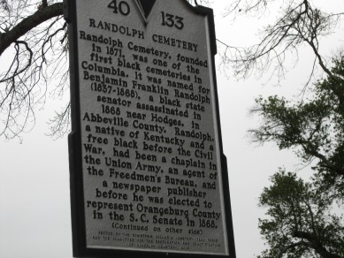
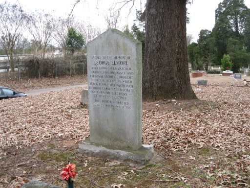
Randolph Cemetery was named after Benjamin Franklin Randolph, an African American Senator for Orangeburg County, who was executed in 1868, by a group of Klan members while he was touring South Carolina. He was re-interred in the cemetery, which was named after him. Most people probably assume that it is part of Elmwood cemetery, but it is not as it was a cemetery for African Americans, while Elmwood was for mostly Whites. I would assume that most of the African Americans here were well to do, or had wealthy connections, as their cemetery survived, while Lower Cemetery got destroyed multiple times. I’ll include more on Lower Cemetery in a bit. Here are some pictures of Randolph Cemetery.
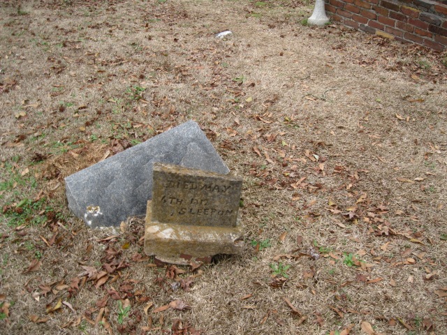
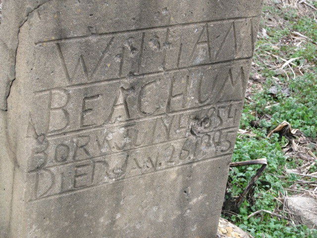
This stone was interesting for me. It reads Died May 4th, Sleep On. It’s simple, yet sad and endearing.
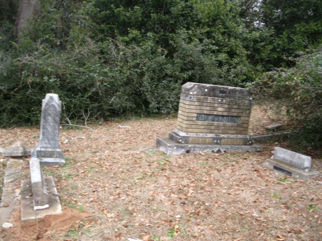
For the most part, the cemetery was in decent condition. It has been restored very well, but in the back there were some crooked stones, rocks as markers, and sunken graves.
After we checked out Randolph, we made our way to the Lower Cemetery. If you are standing at the entrance of Randolph, go all the way to the left in the back, and there is a small trail. We passed by a Hobo camp, but no one was there. We had to go down a pretty steep embankment, so please use all caution if you go. Also, if you read the links I gave you, thousands of South Carolinians are buried on this small plot of land. Literally. They have no idea how many people are buried here, and I read this cemetery failed a shovel test. You can guess what that means. People were buried on top of other graves, and in the late 1800’s the cemetery was seen as an embarrassment to Columbia. You can imagine with I-26 coming through what state it is in. Again, the links above give way more information. Be careful of sunken holes of graves. Please be respectful of the dead when you enter, so do not take anything or leave anything. Keep in mind vandalization to a grave and/or body is a felony.
Lower Cemetery was a public cemetery so it was a burial place for the poor. Though called the Negro Cemetery on many maps and articles, many poor Whites were buried here. Sometimes in death there is equality in race, but certainly not in social class. Most are now anonymous in death, and though the Randolph cemetery was a segregated cemetery, it survived. This cemetery did not, though a few markers remain.
Battle of the Waxhaws Site, near Lancaster, SC
We visited this site earlier this year, but due to forgetfulness and business, I forgot to post this. Now this site is not exactly hidden, and it is one of Banastre Tarleton’s most infamous British victories. Americans argue it was a massacre, but some argue that war is war. I’ll let you read more about the battle on Wikipedia’s page.
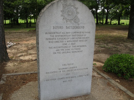
Many people forget about South Carolina’s involvement in the Revolutionary War. More Revolutionary War battles occurred in South Carolina than any other state. Today, some of the major sites are preserved like 96, Camden, and King’s Mountain. Information to get to those sites are readily available online. However, the Battlefield for the Waxhaws (Also known as Buford Battleground) is now a privately own cattle farm.
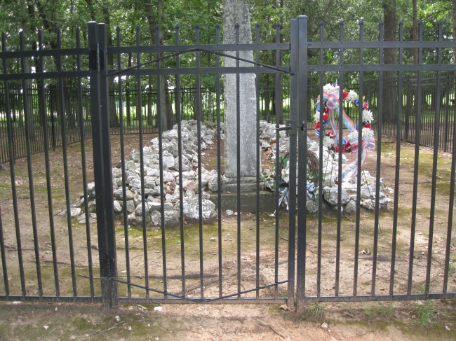
However, there is a small plot of land dedicated to the battle, and includes many graves.
To find the Battle of Waxhaws site, here are the coordinates:



2013 in review
Hopefully this year I will be able to find new places to see. If you have any hidden places in SC like ruins or old historical places, please don’t hesitate to let me know!
Here’s an excerpt:
A San Francisco cable car holds 60 people. This blog was viewed about 1,900 times in 2013. If it were a cable car, it would take about 32 trips to carry that many people.
Hidden Secrets of Oconee
So two posts in one day!!!! WOOO! I bet you are excited to see what else awaits you in South Carolina! This post does include ruins, but that’s a bit further down on the page if you want to skip ahead. If you know anything about me, I’m an avid Gamecock Fan. However, as much as I tout the superiority of the University of South Carolina to Clemson ;), I do respect Clemson greatly as a school and asset to our state. I also recognize that it is located in one of the most GORGEOUS spots in South Carolina. I have been dying to visit Oconee County for years, and the reason might be surprising to you.

Yep.
Some people may or may not be aware, but James Dickey used to be the head of USC’s Southern Studies Department. As a former Southern Studies student, you can imagine that I read this book a lot. A lot= 3 times in college. Rumor has it that Dickey wrote this book while sitting at the edge of the Congaree in downtown Columbia. So to defend all of my Georgia friends, his inspiration could arguably have been Columbia, SC.
However, don’t fret Gamecock friends. The true setting of the novel is along the fictional river Cahulawassee. However, the river was based on the true river, the Chattooga, which meanders from North Carolina, to the border of Georgia and South Carolina, eventually feeding into the Savannah River. So all three states can take the blame of the most infamous male rape setting.
Complex.com
I’ve always been fascinated with this book, and believe it or not is one of the most well written stream of consciousness novels I’ve read. But there is something about the way Dickey speaks about the river.
“’What a view’, I said again. The river was blank and mindless with beauty. It was the most glorious thing I have ever seen. But it was not seeing, really. For once it was not just seeing. It was beholding. I beheld the river in its icy pit of brightness, in its far-below sound and indifference, in its large coil and tiny points and flashes of the moon, in its long sinuous form, in its uncomprehending consequence.” -James Dickey, Deliverance
I’ve wanted to see the river that inspired this novel, and to visit the land around it. I’ve seen the Congaree dozens of times, along with the Saluda and Broad, but I felt the Chattooga River would be more of a personal experience for me. I’ve grown up in North Augusta most of my life, and lived along the Savannah River. I’ve always been in awe of rivers, but the Savannah will of course be my first. The Chattooga River eventually becomes the Savannah River.
I wanted to see the Chattooga of course, but I also wanted to see the history of the area. When I arrived I was not disappointed.
First we visited Stumphouse Tunnel and Issaqueena Falls. This link has more about this.
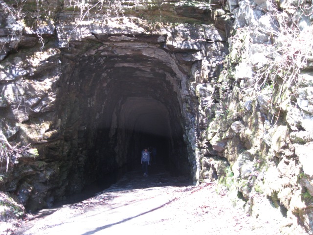
Evidently, you are discouraged from entering if you were wearing any clothing from going into other caves, to protect the bats….this did not make me want to enter.
This was huge. It was a tunnel that was never completed, intending to Charleston to Knoxville to Cincinnati. It was abandoned in 1859 due to funds running out with only roughly 1/5th carved out. The Civil War secured the fact that it would never be completed. Clemson University used it in the 1950’s to make blue cheese. Today it owned by the city of Walhalla.

Yes, the inside was very creepy. This awaited you at the end. This was where the Blue Cheese was stored. It was very dark and damp inside. Those of you that know my fascination with Ghost stories know I immediately tried to find out if there were any, but I could not find any true accounts.
Next to the tunnel is Issaqueena Falls which was definitely beautiful, and very cool that it is literally right next to the tunnel.

Supposedly named after an Indian maiden, whom after finding out her village was going to attack a white settlement, warned the settlers. The village, learning of her betrayal, chased her to this point, where she jumped apparently to her death. The Indians moved on, but unbeknownst to them, she had hidden behind the waterfall, surviving. Looking at this waterfall, its doubtful that she could have hidden behind it, but maybe it looked different then.
If you want to see this site, click here for more directions.
Next we visited on accident to find the river the Fish Hatchery in order to see the Chattooga River. It was pretty entertaining to see the fish jump around.
If you want more information about visiting, you can find it here.
While at the Fish Hatchery, I got to see a little of the Chattooga.
There was a trail that led eventually to the spot where South Carolina, Georgia, and North Carolina meet, but to get there was pretty difficult. Since we were not prepared, we decided to save that for another time.
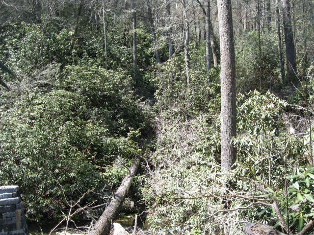
I absolutely love this picture. There are not many places left in the Appalachia Mountains that look as wild as this. Plus it has some plants that give it a tropical look that I imagine is unique to this area.
We moved on and eventually found the Chattooga. I pulled over and got these pictures. Read the description for more.
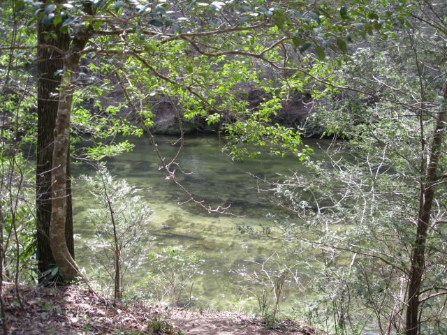
Though I had seen a portion of it earlier near the Hatchery, I was very excited to see the river fully here. It was so green and beautiful that it was stuck in my mind for days. We did not get to see the rapids of the river, but this was worth it. The river was also pretty deep at this point, but it was so clear, you could see straight down.
I can see now why Dickey was so enamored of it.
On our way back, we were not expecting to see anything else, and frankly wanted to get back to Columbia soon. But then we saw this sign.
The sign is self explanatory, but there was another site here. The Russell House ruins were in this location. The settlement was started in 1867, and the other building were built afterwards. Though isolated from civilization, it was easy to see why it would be a good spot. The land was still rich, and on a good location near the river.
For more info, click here:
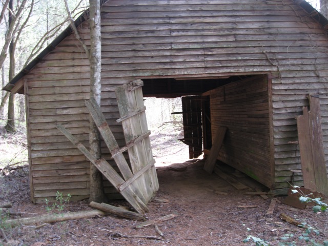
I was interested in seeing the ruins of the place. The house burnt down in the 1980’s, but the other buildings were still around. Read my descriptions for more.

I think I read that this was a corn husk barn. It was still very well preserved. These buildings were very eerie going into. They look like they were part of a post apocalyptic world, had the Apocalypse happened in the 1890’s.
The longer I stayed, the more bothered I was. The place looked like it had been kept up, but it had slipped into decay. This was confirmed when I found out that this place had been used for weddings until the main house burnt down in the late 1980’s.
I then found this site. PLEASE READ.
The area was maintained by the Forest Service until the House built down. I imagine that now it is only minimally maintained. I feel this is the saddest misfortune. If I had all the money in the world, I would like to try to restore the place. It’s history is very fascinating, and now it’s left in ruin. Usually, I like the appeal of the ruins I visit, and want to keep them preserved as is, but with this place, I feel that the house should be rebuilt ( a replica like the Kershaw-Cornwallis House in Camden).
I want to look further into the Russell House and see if there are any efforts to try to save the site. If you have any information for me, please let me know. I’m dying of curiosity.
POST EDIT: Evidently, there is an effort. If you would like to know more please look here and here.
Saluda Factory Ruins and Ruins of Old State Road Bridge
I’m so sorry it’s been awhile updating this blog. I haven’t found anything really new in South Carolina lately. SO…if anyone who reads this blog knows of any unique hidden places or ruins in South Carolina, let me know! Any information from the following post is from this site.
This Saturday, I went to visit the Riverbanks Zoo. I saw lots of lovely animals.
However, we went to see the gardens. Along the way, we stopped by the ruins of of the Old State Road Bridge that was burned by Confederates. You can see this bridge from the bridge separating the Zoo and Gardens. Here are a few photos.
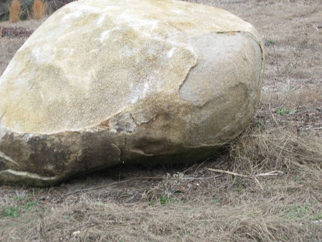
What surprised me the most was stumbling on to a path behind the zoo. This property is owned and protected by Riverbanks Zoo. I found out later that this path lead to the Saluda Factory ruins, which I had heard of before. What I hadn’t heard before was Sherman’s Rock. Supposedly, there is a rock that Sherman stood on, on the eve of the shelling of Columbia. I think it might be the rock in this picture, it was a massive boulder, but I can’t be sure. Next time I’ll ask a worker if they know.
I did not know much about the Saluda River Factory. According to Riverbanks Zoo, it was built in 1830 and one of South Carolina’s Oldest Textile Mills. If so, that pre-dates Graniteville Textiles, which I had assumed to be the oldest textile mill in South Carolina by 15 years. You can read more about Graniteville in my post here.
The mill was destroyed by Sherman, but rebuilt after the Civil War. I do not know if they used the same stones and structure, but it accidentally burnt down in 1884. According to Riverbanks, the ruins include “remnants of the granite foundations of the mill, picking house and millrace” (Riverbanks History). The mill at one point produced uniforms for Confederate soldiers, so burning it was strategic for Sherman’s Advance.
After traveling the trail we found the ruins. The following pictures are of the Saluda Factory.
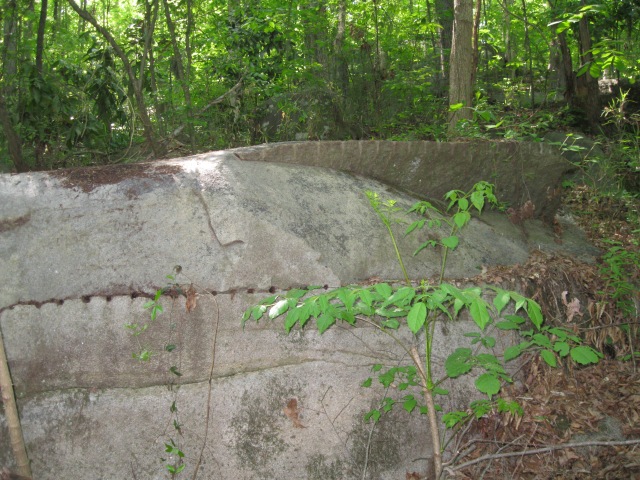
Abandoned granite blocks being chipped out of boulders. This was actually near the end of the path, but these were left behind after the fire.
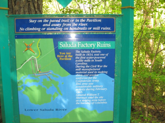
We actually went around and looked into the ruins. I suggest that you do not do the same. We saw a trail, and assumed it was ok to do so. Sadly, even though I took a picture of this sign, I did not read carefully, and trespassed accidentally. You can see the ruins easily enough from the viewing platform they have built. There were quite a few beer bottles and trash scattered about, so please respect the wishes of the zoo. Had I not been so excited to see the ruins, I would have been more careful :P.
Since my knowledge of mills of the 1800’s are very limited, I do not know what structures these originally were. At Riverbanks, you can visit the Saluda Factory Interpretive Center, but when we arrived, it was closed. They may be of further assistance if you choose to visit this area. It is very public, as long as you pay the zoo fee. It’s a very good deal for a day at the zoo, and a trip back into time! Plus you get to meet this guy!
 If you know any more about the ruins or any other places in SC, don’t hesitate to let me know!
Long Canes Massacre, Badwell Cemetery and Guillebeau Cemetery, McCormick South Carolina
I apologize for not having any new posts lately. I’ve been student teaching this year, and now I actually have time to pursue my other interests. A few weeks ago, I visited the Long Canes Massacre site in McCormick County. Today, I just got back from visiting McCormick and Abbeville County finding ruined sites. I know what you must think….I’m very boring. I’ve always been interested in finding lost sites, and I had heard about the Long Canes site for a couple of years now. Sadly, the reason I end up finding these sites is by my interest in the paranormal. I love visiting “haunted sites”, and that’s how I ended up finding Long Canes and Badwell Cemetery.
I first heard about Long Canes years ago, on a website showing a paranormal investigation. Supposedly, screams could be heard in the forest. I originally wanted to visit during the night, but when I heard more about the history, I wanted to visit during the daytime.
This link tells much more about the story, but during the Cherokee War in 1760, Settlers in the back country were evacuating to Augusta to escape the violence. A large group was intercepted by about 100 Cherokee, and 23 men, women, and children were killed. The group scattered escaping the attack, but reports claim that days later, children with hatchet marks in their skulls were found wandering the wilderness days later. Ann Calhoun was taken hostage by the Indians at age 5, and returned to her family at age 12. One other child was taken and never recovered, but not included in the death list. Twenty something Cherokee were also killed.
The most famous death is of course John C. Calhoun’s grandmother Catherine Montgomery Calhoun. She is buried separate from the rest of the settlers, who are buried in a mass grave.
I’ve tried to find out if the Cherokee who were died were buried in the mass grave with the Settlers, but I’m not sure they would be. I wasn’t sure where the mass grave was located either on site, but here is another picture of the other headstone.
One thing that I was curious about was the fact that on the headstones, people had placed rocks. I searched the internet to see what the tradition was about, but I had no clue. I imagine it has something to do with ghost hunting at the site after night.
Today, I visited McCormick County again, and this time inspired by paranormal events, discovered a new site. Badwell Cemetery, which I saw supposedly has a “Troll” that lumbers around the stone walls of the cemetery. But I was there to find this little piece of lost history. Badwell Plantation was owned by the Petigru family, and the land was inhabited by Huguenots. This is the same Petigru family of James Petigru, the man against South Carolina’s Secession. He also came up with the famous quote of “South Carolina is too small for a republic and too large for an insane asylum.” He is not buried in the Cemetery.
The story of how we found the place is creepier than the place itself. We put the coordinates in the GPS, but could not find Badwell. Then we put in a different site that we were interested in seeing, and the GPS led us down a dirt road that was part of a private property. We immediately turned around, but then the GPS led us down Badwell Cemetery Road. This would sound like a cool coincidence, but the site is a dead end in the middle of the forest, and there is no reason the GPS would take us down a dead end road.
However, we found our site, and here are a few pictures of the area. Sadly, I did not get any pictures of the Poteet Funeral Home markings of graves in the surrounding woods. Evidently, when the lake was being filled with water, the bodies of a nearby cemetery were moved to Badwell. However, pictures of this, the old grim reaper gate (it was painted over when we visited), is on this site.

Entrance to the Cemetery. The Cast Iron Grim Reaper on the gate was stolen long ago, but the imprint used to remain. However, the gate had been painted over, so the imprint was gone.

Capt Joseph Blyth Allston “Born in Georgetown, S.C.. A true poet and gallant soldoer in the war for Southern Independance. Honored by all who knew him.”

This is a headstone for a burial outside the cemetery of a slave named Daddy Tom. He must have been very well loved by the family to receive his own marker. It reads “A faithful servant and honest, departed this life the 9th day of February 1857. Born on this place before 1776. A kindly temper, a cheerful Obedience and willingness to work Conciliated the regard of those Who treated him in his Life time, as a Friend, And caused him when he died To be buried like a Christian.” This stone is a replica of the one that stood before.
We also visited Guillebeau Cemetery, which part of the New Bordeaux settlement before McCormick County existed. New Bordeaux was a Huguenot settlement, almost lost to history. We tried finding the marker for the Huguenot Church, but could not find it. We did find the Guillebeau Cemetery.
We also found Mt. Carmel, SC and found these few treasures.

Fort Charlotte Historical Marker. We tried to find it, but we found out from a park ranger that the ruins of the fort were claimed by Lake Strom Thurmond/ClarksHill. Another sad instance of history being claimed by the lake.
In all, visiting McCormick and Abbeville Counties in South Carolina was a truly awesome experience. I hope to visit again soon. If you have anything to add, please feel free to ask below. With my Graniteville post, many people had questions and comments, but keep in mind I may not know the answers to everything. Hope you enjoyed!


